")
A New Vision for Inspection and Monitoring, Design, Planning, and Asset Management
Your own branded portal for all your survey data – Store and view all your survey data from any source – Point Clouds, Textured Meshes, HD Images, 360 Panoramics, Orthos, Models, Line Work, Maps and Documents – in one place.
Create and collaborate on deliverables – Whatever your project, however large, use VISION online tools to create powerful deliverables and collaborate easily with stakeholders, on any device, anywhere.
Unlimited Users – in self-contained project UserNets – Control the flow and use of data internally and with clients, without user quotas, and with different user levels of permissions.
Visual quality, accuracy and user experience come first – Whatever the device you are viewing on and whatever data you are viewing.
Answering the needs of the New World of Survey
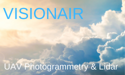
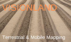
However, you capture your data……
From the Air with UAV Photogrammetry and Lidar; on Land with Terrestrial Scanners and Mobile Mapping; on or under the Water with Surface Vessels and AUVs.
Whatever your Survey project…..
Inspection, Monitoring, Management or Construction of Transport and Energy Corridors; Power Generation, Oil and Gas Infrastructure; Quarries and Mines; Cities, Buildings, Heritage; Rivers, Ports, Coasts; Forests and Fields.
VISION delivers efficiency at scale
With all your visual and document survey data in one place, easy to use online tools for deliverables and no limits to users, enjoy rapid improvements in project efficiency.
Learn More
Learn More

Learn More
Free Trial / Buy Now
Your own Branded Portal to suit you and your Customers’ needs
Flexible Modular approach
Add Image and Mesh modules to your VISION Core licence on your account only if and when you need them.
A single annual subscription to a Core license and any modules, covers that functionality for all your customers and projects.
Unlimited Users on all Projects
Add unlimited internal and client users in self-contained project UserNets, no separate individual user licenses required
For new clients and projects just set up new UserNets and assign different level permissions as needed.
Add resources only when needed
Additional UserNets and data can be added to your annual subscription at any time.
One-off additional Image allowances and training can be easily purchased when required
VISIONCore
(Required Module)
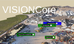
Comprehensive online functions for Point Clouds, Models, Line Work and Mapping deliverables.
Link to documents and key Survey information in self contained Document repository.
VISIONImage
(Optional Module)
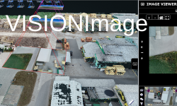
View geo-located and non-oriented HD Images and 360 Panoramics on Point Clouds and Textured Meshes
Unique Image selection, Zoom and Mark-up process added to your Core licence functionality.
VISIONMesh
(Optional Module)

View High-Res Textured Meshes in 3D Tile format created from software such as Reality Capture, Pix4D & Context Capture.
Blend with Point Cloud and Model data to create optimum visual deliverables