UK based Geotechnical and Survey consultancy Land and Minerals Consulting Ltd have recently completed a major multi-sensor survey for a design project for the cable car station at the top of the Rock of Gibraltar, using the 3DUserNetVISION platform as an essential part of the delivery.
The survey included the cliff faces, the cable car station itself, and underground caverns. A variety of techniques were used to capture the data; including UAV imagery /photogrammetry and backpack mounted LiDAR (specifically GEXCEL’s HERON MS Twin). A photogrammetrically derived model was combined with the LiDAR data to create a composite dataset. This dataset was then uploaded to 3DUserNetVISION.
Says Dan Pestell the GeoSpatial Data Engineer on the project.“It was a challenging project and we needed the ability to easily combine data from different instruments and software into the one view to collaborate with the client.”
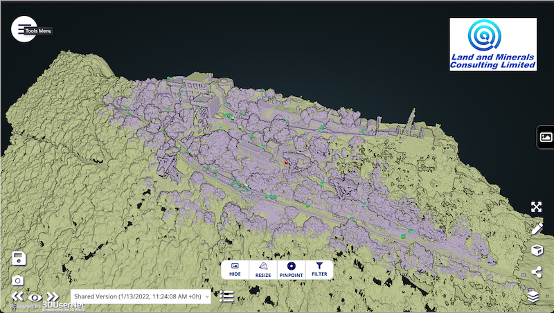
“The seamless flow path from Reconstructor made it very simple and easy to merge both the UAV and LiDAR data to show the client all the data that had been captured. It worked well to showcase everything and it aided in deciding the next steps for the project, including helping the client decide on a list of final deliverables”
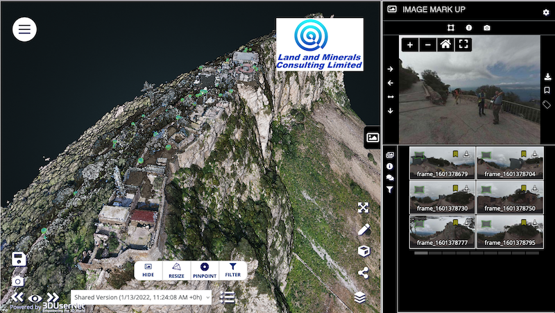
“3DUserNet Vision is a great tool that all of us at LMCL use regularly. The ability to upload data to a portal that can be accessed by anyone with an internet connection proved crucial for this project in particular.
The platform also works well to showcase our highly-detailed data to potential clients as they can easily see all that we at LMCL are capable of.”
Paul Snudden CEO at 3DUserNet – “It’s great to see all the features being used so fully to make a real difference to a major project. With the rapid growth on Multi Sensor projects our VISION platform leads the way in faster more efficient project delivery.”